Kingston, Jamaica — As the 2025 Atlantic hurricane season reaches a dramatic peak, Hurricane Melissa has intensified into a Category 5 storm and is bearing down on Jamaica with unprecedented ferocity. Experts warn that the island could be facing one of the most devastating natural disasters in its history.
Strength and Path
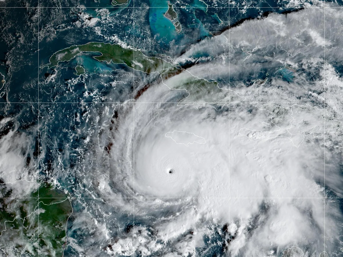
Forecasters at the U.S. National Hurricane Center (NHC) report sustained winds exceeding 160 mph (≈ 260 km/h). Some estimates place gusts even higher — up to 185 mph in isolated fields.
What makes Melissa especially perilous is its slow forward motion. The storm is moving west-northwest at only about 5-9 mph, meaning that affected areas will experience the full brunt of destructive winds, torrential rainfall and storm surge for many hours.
The island is forecast to receive up to 76 cm (30 inches) or more of rainfall in some regions, alongside a storm surge of 4 meters or higher along vulnerable coastal areas.
Preparations & Government Response
Jamaican authorities have issued mandatory evacuation orders in the most exposed districts, including low-lying parishes like Westmoreland, St Elizabeth, Manchester and Clarendon. Over 800 shelters have been opened island-wide, with transportation arranged to assist thousands of residents.
Prime Minister Andrew Holness declared the situation “the worst we likely will ever face,” urging citizens to treat this as a life-or-death moment:
“There is no infrastructure in the region that can withstand a Category 5.” WTAE
Major airports and key transport hubs have been closed preemptively. Power and water systems are already failing in some parishes as trees are uprooted and lines toppled by the wind. The Washington Post
Impacts and Anticipated Damage
With the storm’s eye expected to cross near Jamaica’s southwest and central region, the island is bracing for massive impact across multiple fronts:
- Wind destruction: Roofs ripped off, vehicles flipped, trees snapped.
- Flash flooding & landslides: Saturated soils in the mountainous interior may trigger deadly slides, isolating communities.
- Storm surge: Coastal settlements risk being inundated by extreme waves and ocean surge up to 13 feet in places.
- Long-term disruption: Power, communication networks, bridges and roads may be out of operation for days or weeks. Access to relief will likely be challenged.
Why This Is Exceptional
Meteorologists highlight several features making Melissa especially dangerous:
- Rapid intensification into Category 5 near Jamaica – rare in this region.
- Slow speed over land – prolonging destructive conditions.
- Very warm Caribbean waters feeding the storm’s energy – a trend consistent with climate-driven extremes.
What Happens Next
As the storm makes landfall in the coming hours, local emergency agencies and international partners are standing by. The immediate focus will be on search and rescue, delivering emergency supplies, clearing critical routes, and restoring power and communications.
Recovery will be extensive — rebuilding homes, repairing infrastructure and ensuring communities displaced by floods and wind have safe shelter.
Final Thoughts
For Jamaica, Hurricane Melissa is more than just a weather event — it is a test of resilience and preparedness. But with strong warnings, coordinated checks and a nation braced for impact, the hope remains that loss of life can be minimised, and that recovery begins as soon as the winds subside.
—
(Reporting from Kingston; updates will follow as conditions evolve.)


More Stories
Mojtaba Khamenei Takes Power in Iran as Global Oil Prices Surge Above $100
Liverpool Star Diogo Jota Tragically Killed in Car Crash in Spain
Gaza Beach Café Strike Deepens Crisis, Fuels Fury